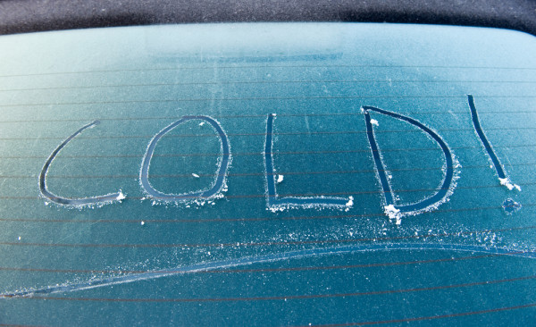
FROSTY mornings and windy days are on the Swan Hill weather menu for the rest of the week.
However, it’s nothing that long time residents of the region aren’t used to, with Bureau of Meteorology forecaster Peter Blake saying it was typical for the Mallee to experience cooler, windier weather this time of year.
“We do usually get this cold air coming from the south,” Mr Blake said.
“Pretty much every year since 2000 there’s been a day of 10 or 11 degrees maximum temperature.”
Early Monday morning Swan Hill recorded winds of 61km/h, the strongest wind speed seen this winter.
Mr Blake told The Guardian the strong winds were responsible for the chill in the air.
“It hasn’t been too bad — the winds make it feel much worse,” he said.
Mr Blake warned Swan Hill residents to prepare to wake up to frost in coming weeks, brought on by clear, still nights which cause the temperature to drop.
Another frontal system is going through western Victoria today and tomorrow, bringing more showers and possible hail.
“Maximum temperatures will be into the low double figures,” Mr Blake said.
Pick up today’s Guardian (Wednesday July 15) for more.