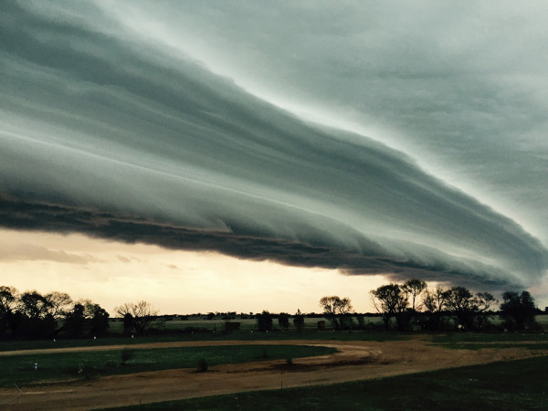
A SPECTACULAR cloud formation over the Swan Hill region early yesterday morning was the result of an abrupt cool wind change, according to a weather expert.
Richard Carlyon, a Bureau of Meteorology senior forecaster, said the structure was the perfect example of a shelf cloud — a low-hanging, horizontal and often ominous-looking formation that occurs along “the leading edge” of a cool change.
He said the Swan Hill region experienced an “abrupt wind shift” at 6.40am when the wind direction swung from northerly to westerly.
“I’d say that shelf cloud was ahead of that cooler change,” he said.
While the cloud made for some breathtaking photographs, including this one taken by Amanda Maher at Pira, Mr Carlyon said shelf clouds were not uncommon.
“They’re reasonably common in southern Victoria and in many active cool changes.
“However, this is a great example.”