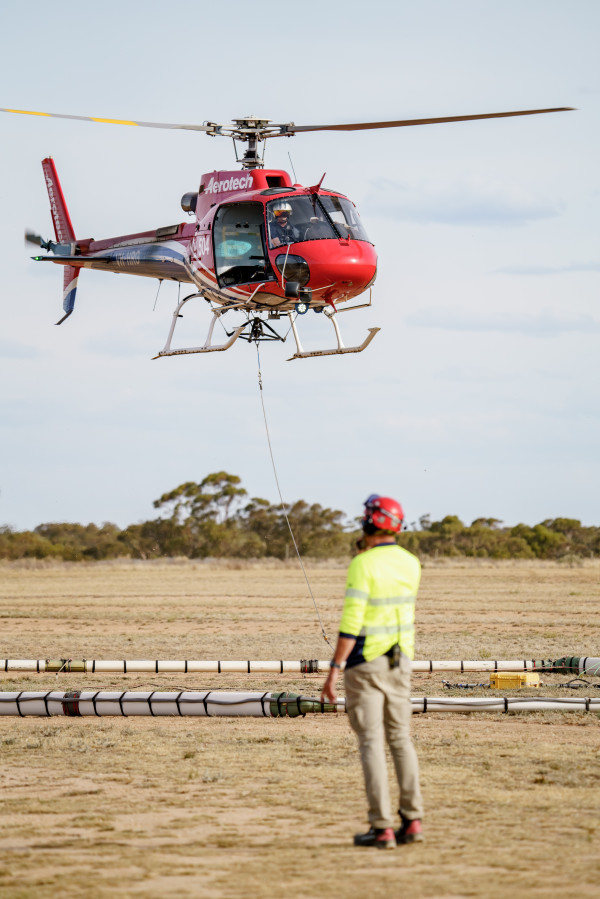
A LOW-flying helicopter with a contraption akin to an upside-down Hills Hoist will be seen over the eastern portion of the region as part of a Victorian Murray River and groundwater salinity study.
The helicopter will conclude its 770km stretch from the South Australian border at Nyah, stopping short of reaching Swan Hill.
While the survey poses no risk to the community and will avoid built-up areas, the Mallee Catchment Management Authority (Mallee CMA) has been in contact with affected communities about the safety of their livestock.
“We’ve done a lot of communication with horse owners, pony clubs, livestock owners and agents, talking to them about when to expect it and what to look out for,” manager of strategic communications at Mallee CMA Lauren Ware said.
“At this stage we’ve had a really good response and there haven’t been any incidents of skittish animals, and we’re finding a lot of the time when the helicopter does go over the animals are interested and just look.
“It is awesome to see: it’s a lot larger and a lot more of a spectacle to see than the photos might indicate.
“If you do see it, please don’t be alarmed.
“Have a talk to us or jump online to see the information on why it’s so important to get the most data we can to manage salinity in our region.”
This survey is the third of its kind and first since 2007, utilising new technologies to better understand the impact of salinity on the region over time, and for the first time extending the data collection to the floodplains up to 25km inland from the river.
The data is collected through the transmitter and receiver coil hanging from the helicopter in a process known as airborne electromagnetic (AEM) survey.
The electromagnetic currents emitted by AEM are smaller than those from a mobile phone, TV or radio but can measure up to 40 metres below the ground.
The survey is part of ongoing research on and management of Murray River salinity and the impact of groundwater salinity in Victoria and will help to identify the areas most at risk from the negative impacts of salinity and plan for a sustainable future for irrigated horticulture.
The results should show the depth, distribution and accumulation of saline groundwater and salt, the location and depth of clay layers that influence the movement of groundwater, and the salinity concentration of the groundwater.
“Data calibration can take months and months and is being handled by the CSIRO,” Ms Ware said.
“We’re very excited about what the results will tell us about our region.”